- IMG_4573.JPG (2.2 MiB) Viewed 2316 times
We dropped the trailers and decided to head up Raven's Roost to see what we could find. To say what we found was spectacular would be a gross understatement. Here are some of the highlights:
- IMG_4575.JPG (1.53 MiB) Viewed 2316 times
- IMG_4576.JPG (1.25 MiB) Viewed 2316 times
- IMG_4579.JPG (1.38 MiB) Viewed 2316 times
- IMG_4581.JPG (1.61 MiB) Viewed 2316 times
- IMG_4592.JPG (1.29 MiB) Viewed 2316 times
- IMG_4596.JPG (1.38 MiB) Viewed 2316 times
- IMG_4597.JPG (1.39 MiB) Viewed 2316 times
- IMG_4598.JPG (1.36 MiB) Viewed 2316 times
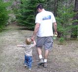
It truly seemed as though things could not have possibly gotten any better, but they did with the addition of Ryder's dawgs
- IMG_4605.JPG (1.65 MiB) Viewed 2316 times
With adequately fully tummys, we decided to head back down the hill to see what else we could find for the afternoon:
- IMG_4614.JPG (1.28 MiB) Viewed 2316 times
- IMG_4615.JPG (1.54 MiB) Viewed 2316 times
- IMG_4616.JPG (1.34 MiB) Viewed 2316 times
- IMG_4618.JPG (1.28 MiB) Viewed 2316 times
- IMG_4625.JPG (1.33 MiB) Viewed 2316 times
- IMG_4626.JPG (1.92 MiB) Viewed 2316 times
Arriving back at Crow Creek, we took a look at the map and pondered the options. What jumped out at us both was a seemly new set of trails, at least in that neither of us had ever paid attention to them before... And the names of them simply could not be ignored: Bad Monkey, Crazy Monkey, and Silly Monkey??!! How had we not seen these before, particularly with them being right off 1901 and so close to Long Meadow. For reference, here is a map with Bad Monkey shown in Red, and Crazy and Silly Monkies shown in purple:
- Monkey Map.jpg (435.36 KiB) Viewed 2316 times
We took Bad Monkey first, which tied us into 4W-676 and 1903 back down to NF-19:
- IMG_4627.JPG (2 MiB) Viewed 2316 times
- IMG_4629.JPG (1.92 MiB) Viewed 2316 times
- IMG_4632.JPG (1.96 MiB) Viewed 2316 times
- IMG_4633.JPG (2.04 MiB) Viewed 2316 times
- IMG_4636.JPG (1.68 MiB) Viewed 2316 times
- IMG_4638.JPG (1.78 MiB) Viewed 2316 times
Arriving back at the same intersection, we this time took the other direction and headed onto Silly Monkey out toward Horsetail Falls, eventually looping us once again back to 1901. Right near the intersection back onto 1901, we hit paydirt and scooped up some great looking firewood at an abandoned campsite:
- IMG_4639.JPG (1.69 MiB) Viewed 2316 times
With nightfall rapidly approaching, we did the sensible thing and took a right onto 1901 heading deeper into the woods and away from camp. We quickly hopped back off 1901 and onto the connector trail I had recently found that ties 1901 to 1708:
- IMG_4641.JPG (1.78 MiB) Viewed 2316 times
- IMG_4643.JPG (1.76 MiB) Viewed 2316 times
We wanted to try and explore the area south of Devils Slide, but the route we could see on the map turned out to be a motorcycle trail as we scouted the trailhead. We took stock of the situation, and decided to push further on the main road as it appeared to eventually let out back down at Hwy 410 near Cliffdell. Frustratingly, about 300-yards from Hwy 410 the road was barricaded off due to a washout, so we were forced to backtrack all the way back to 1708 and make our way back to camp for the evening...
Upon arrival back at camp, we lit the campfire and proceeded to eat, drink, and tell lies deep into the night. We fell asleep in pleasantly mild temperatures, punctuated by the sweet music of a light drizzle knocking us out for the night:
- IMG_4649.JPG (1.43 MiB) Viewed 2316 times
- IMG_4645.JPG (1.24 MiB) Viewed 2316 times
- IMG_4650.JPG (1.01 MiB) Viewed 2316 times
- IMG_4651.JPG (990.11 KiB) Viewed 2316 times
We awoke Sunday morning to a very light skiff of white stuff:
- IMG_4653.JPG (1.95 MiB) Viewed 2316 times
After some coffee and conversation, it was decided we would once again explore the area south of Devil's Slide, this time entering from a different vantage point off of 1703. The route we travelled looks similar to a plate of spaghetti dumped on the table, but I believe OG was dropping breadcrumbs all day and might be able to share an overview map, but regardless of all that we had an absolute blast exploring the new-to-us trails and terrain:
- IMG_4655.JPG (1.5 MiB) Viewed 2316 times
- IMG_4657.JPG (1.34 MiB) Viewed 2316 times
- IMG_4659.JPG (1.55 MiB) Viewed 2316 times
- IMG_4661.JPG (1.37 MiB) Viewed 2316 times
- IMG_4665.JPG (1.33 MiB) Viewed 2316 times
- IMG_4666.JPG (1.54 MiB) Viewed 2316 times
At the bottom of this seemingly unassuming hill, I let OG have some space because of the potential for a bobsled situation. Sure enough, after a couple of rapid trips back down, OG gave it one last shot and cleared the top. However, he called over the radio that he had also lost all manner of brakes
- IMG_4669.JPG (1.25 MiB) Viewed 2316 times
Although the goal for the day had been to find an alternate route into the back side of the Moon Rocks, and it was literally almost within eyesight, we decided to gingerly make our way back down to the main FS road and limp back to camp, leaving the exploration and comparatively difficult trail for another day:
- IMG_4673.JPG (1.51 MiB) Viewed 2316 times
- IMG_4674.JPG (1.01 MiB) Viewed 2316 times
- IMG_4675.JPG (1.24 MiB) Viewed 2316 times
- IMG_4677.JPG (2 MiB) Viewed 2316 times
- IMG_4678.JPG (1.66 MiB) Viewed 2316 times
We aired up at the bottom of Rock Creek:
- IMG_4679.JPG (2.16 MiB) Viewed 2316 times
From here we made the quick journey back to Long Meadow to break camp and head for home. It had been an unbelievable pair of days in the hills, filled with literally everything you could hope for in an adventure weekend: foul weather, amazing weather, getting lost, great trails, great food, and a great friend to share it all with. I can't wait for the next one

