Page 2 of 2
Posted: Sun Jun 29, 2008 4:54 pm
by White trash
I'll have the wife do some digging, I'm sure she can find the owners name.... As far as we've always known it was just state land between fields and whatnot but if that's not the case then it'll make it easier to know who to talk to about doing a clean up out there to pick up all the crap that the shooters leave behind...

Posted: Sun Jun 29, 2008 5:21 pm
by Grumpy
My understanding is that BLM has some involvement out there. They were in on a land exchange for the realignment of the main road...
Posted: Sun Jun 29, 2008 7:42 pm
by SPR
If you're talking about your Weber Canyon Trail.... I should belong to BLM
Steve
Posted: Thu Jul 10, 2008 3:15 pm
by OldGreen
For reference, I am pretty sure that Screamin' Grumpy Toilet are correct. . .
Even the deputies that poke their heads in to look at us once in a while say we are good to go.
Posted: Thu Sep 04, 2008 6:14 pm
by SPR
Here is the map. You guys can figure out where your trail is and who owns it. The brown stuff belongs to BLM
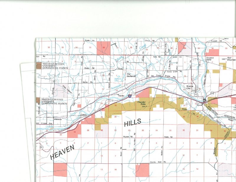
Posted: Fri Sep 05, 2008 1:08 am
by White trash
I'd bet money its in the red circle.. I just dropped off the hill by it tonight and the canyon starts right after the big corner coming down.


Posted: Fri Sep 05, 2008 5:10 am
by toyman2
i agree with WT on location