Nachies over the 4th
Moderator: TJDave
Nachies over the 4th
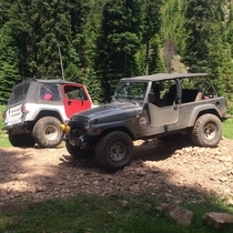
So I was thinking of heading to the funny and moon rocks over the 4th of July. As far as I know it will be just my jeep, are there any rules about camping along the trails? We were thinking of loading the jeep and camping out of it for the 3 days.

Easiest way to get there that I know of is Forest Service Road 1701. It is the next right just after Jim Sprick Community Park in the Nile Valley. Way before you get to Whistlin Jacks. We take this route every year during the Jamboree. There is a ton of dispersed camping areas along the way before you get to the trail. Some wide open, some just clearings in the trees.
Here's a little something I pulled off the NWJeepn website.
http://www.nwjeepn.com/WAtrails.htm
Here's a little something I pulled off the NWJeepn website.
http://www.nwjeepn.com/WAtrails.htm
The Summit trail runs west from the FS-1701 road on Manastash Ridge to the junction with 4W307 Tripod Flats and 4W685 Milk lake trails.
Along the way the trail winds through dense forest, small meadows and along the ridge line affording views of Manastash Lake far below and it's feature obstacle, Funny Rocks.
Funny Rocks is located about half way along the trail and provides a popular playground for rock crawling but is much smaller in area than nearby Moon Rocks which is located on the 4W695 Mid Summit trail.
2018 JLU Rubicon
Tow bar mount
Trailer hitch
Tow bar mount
Trailer hitch

toyman2 wrote:I saw that, I'm not 100% sure where that is. isn't it past Ellensburg?
Between Ellensburg and Wenatchee. Directions are in the thread. Gonna be a good time.
Lee
Okay, we're a little crazy to have a Duramax for a daily driver. But if we go off our meds, we might wind up in a Prius.
If you want to hear God laugh, tell Him your plans.
N7EEL WROD249


If you want to hear God laugh, tell Him your plans.
N7EEL WROD249

That is what I read.
I'm looking at to he map I bought last year. Can someone that has a marked map tell me which trail number is what trail? Like it looks like 4w330 is the shoe string and like 4W306 is the old Naches pass trail that takes you to the west side, I also think there was some bridges you have to cross and there was a cabin and by story signs up there. If I remember right, the shoe string trail had a old cabin on it also. But trail numbers to trail names if you would be willing to share would be a huge help. I know there are a lot of trails not on the map that I have been on. Also looking for GPS coordinate for the funny rocks, or like the township and range would be ok also.
Sorry that's a lot in one post.

This has already been posted:
http://www.nwjeepn.com/WAtrails.htm
Naches official version:
http://www.fs.usda.gov/activity/okawen/ ... 3&actid=93
4w306: Manastash Ridge
4w330: Tipover
4w308: Shoestring
4w684: Naches
http://www.nwjeepn.com/WAtrails.htm
Naches official version:
http://www.fs.usda.gov/activity/okawen/ ... 3&actid=93
4w306: Manastash Ridge
4w330: Tipover
4w308: Shoestring
4w684: Naches
James
'92 YJ with a little something of everything.
'92 YJ with a little something of everything.


Who is online
Users browsing this forum: No registered users and 71 guests